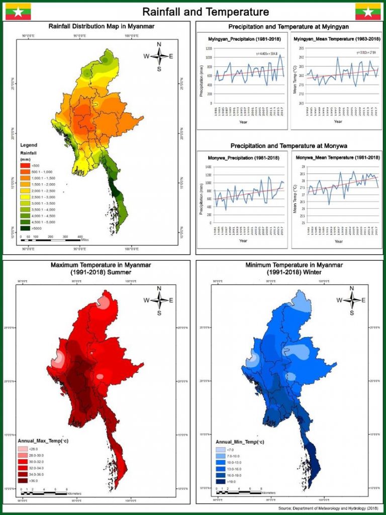
The rainfall in the central Myanmar dry zone is determined by its location and topography. Located on the north of central Myanmar dry zone is the northern mountain ranges, on the east Shan plateau, on the west Rakhine Yoma and only on the south is the low-lying terrain.
The following main points will be found from the analysis of its rainfall.
(a) Except Mount Popa which has the elevation of 4981 ft (1518 m), there are no mountain ranges which can act as a wind break to prevent south-west monsoon.
(b) The whole region tends to be a Rain Shadow Area with the rainfall of 40 inches (1016 mm) and below because of a low range of hills/mountains which ranges from south to north. The region receives only the rainfall amount of only 3.2% of the whole country and the average rainfall of the whole region is only about 28.44 inches (722.4 mm).
(c) Rains occur only twice a year: once from the end of May until June and once from September to October. Likely to be lack of rains during July and August. Rains often occur early or late depending on the onset of monsoon.
(d) As the rainfall in the September is usually at its peak, the pre-monsoon season needs to occur early with regular rainfall in June from trees planting aspects. It has been observed that if June receives regular rainfall, the plants grow well and survive. As the tree planting operations of the central Myanmar dry zone depend largely on the rainfall of the region, it is necessary to keep studying on its rainfall status and trends.


